
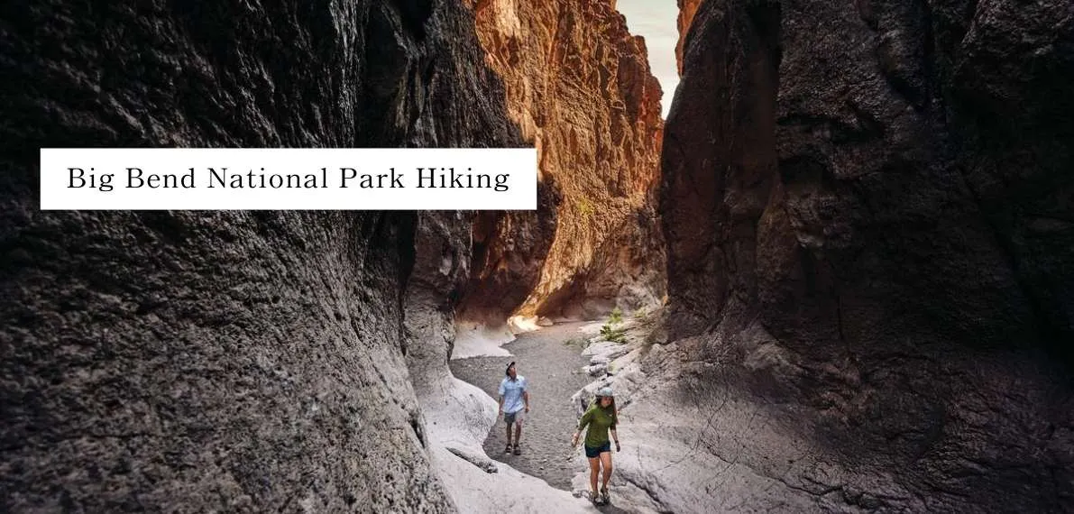
Big Bend National Park, a vast wilderness in southwestern Texas, is a dream for hikers craving adventure. Spanning over 800,000 acres, it’s home to rugged Chisos Mountains, dramatic canyons carved by the Rio Grande, and endless Chihuahuan Desert vistas. Whether you’re a seasoned trekker or a casual explorer, these 10 best Big Bend National Park hiking trails—curated by NationalParkShops.com—offer something unforgettable. From challenging peaks to soothing hot springs, let’s dive into what makes Big Bend a hiker’s paradise in 2025!
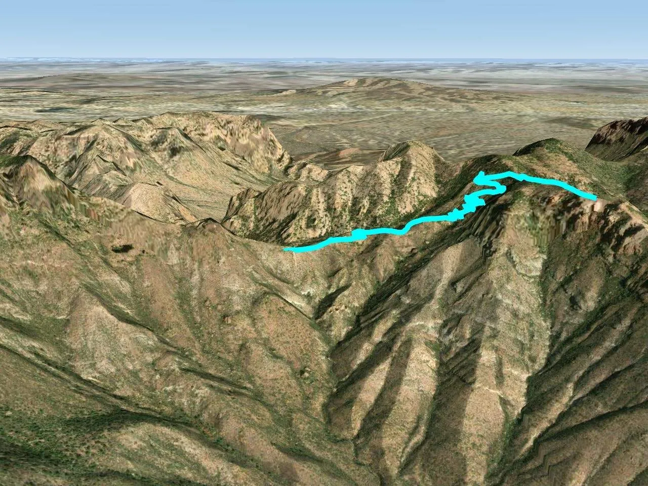
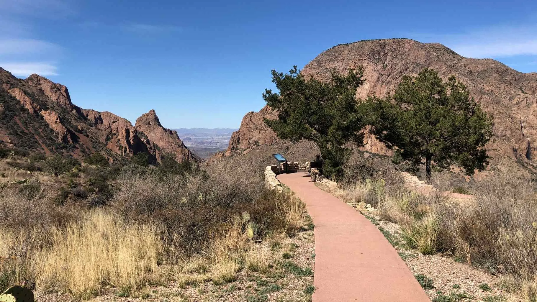
1. South Rim Trail: A Challenging Desert Adventure
- Distance: 12.6 miles (round trip)
- Elevation Gain: 2,800 feet
- Difficulty: Challenging
- Duration: 6-8 hours
- Trailhead: Chisos Basin Visitor Center
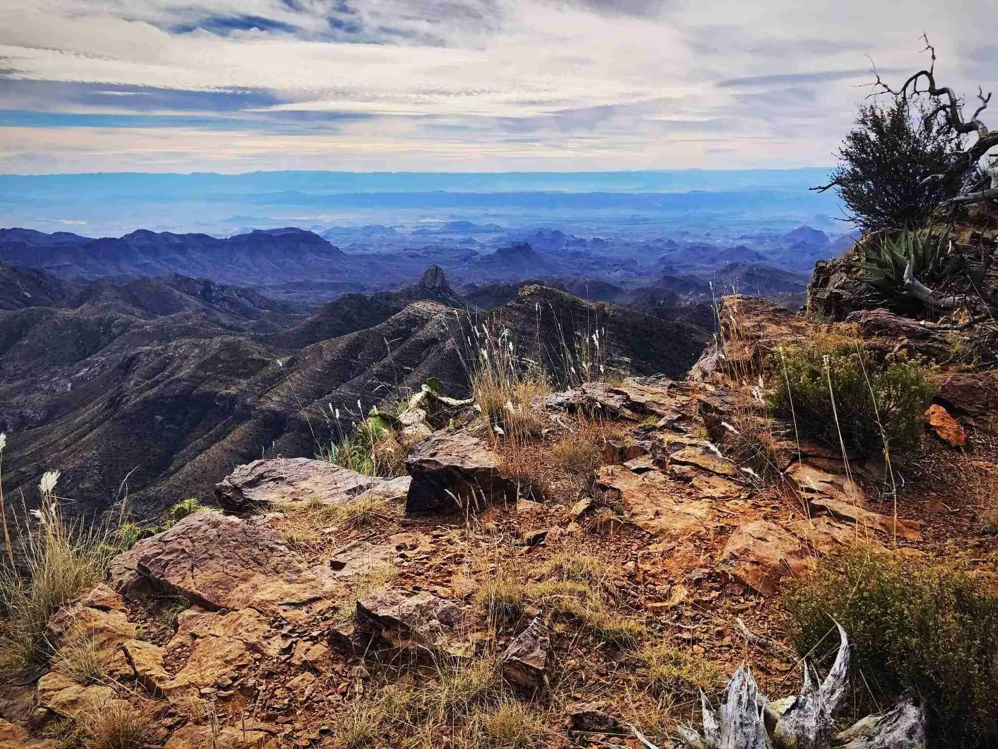
The South Rim Trail is Big Bend’s crown jewel, delivering panoramic views that stretch across the Chihuahuan Desert into Mexico. Starting at Chisos Basin, you’ll wind through oak and pine forests before hitting open ridgelines. At the rim, expect a jaw-dropping 270-degree vista—perfect for sunrise or sunset hikes. For an extra thrill, tack on the 1.5-mile detour to Emory Peak (7,825 feet), which includes a rocky scramble to the park’s highest point.
Seasonal Insight: March 2025 offers mild temps (50-70°F), ideal for this strenuous hike. Summer can hit 100°F—start before dawn if hiking then.
Gear Tip: Bring trekking poles for the steep descents and at least 3-4 liters of water—no streams or springs here.
Wildlife Watch: Look for black bears and mountain lions, especially in the forested sections.
2. Lost Mine Trail: Scenic Views for All Levels
- Distance: 4.8 miles (out-and-back)
- Elevation Gain: 1,224 feet
- Difficulty: Moderate
- Duration: 2.5-3.5 hours
- Trailhead: Basin Junction Road, Mile Marker 5
Lost Mine Trail strikes a perfect balance: manageable effort, massive payoff. The gradual ascent offers teasing glimpses of the Chisos Mountains through juniper and piñon pines. At the summit (6,850 feet), you’re treated to a sweeping view of Casa Grande, Juniper Canyon, and beyond. The small parking lot (20 cars) fills fast—arrive by 7 AM to beat the rush.
History Nugget: Named after a rumored Spanish gold mine lost to time, some say the peak hides untold riches—though the real treasure is the view.
Best Time: Fall (October-November) for cooler weather and golden foliage.
Pro Tip: Bring binoculars; peregrine falcons often soar above the cliffs.
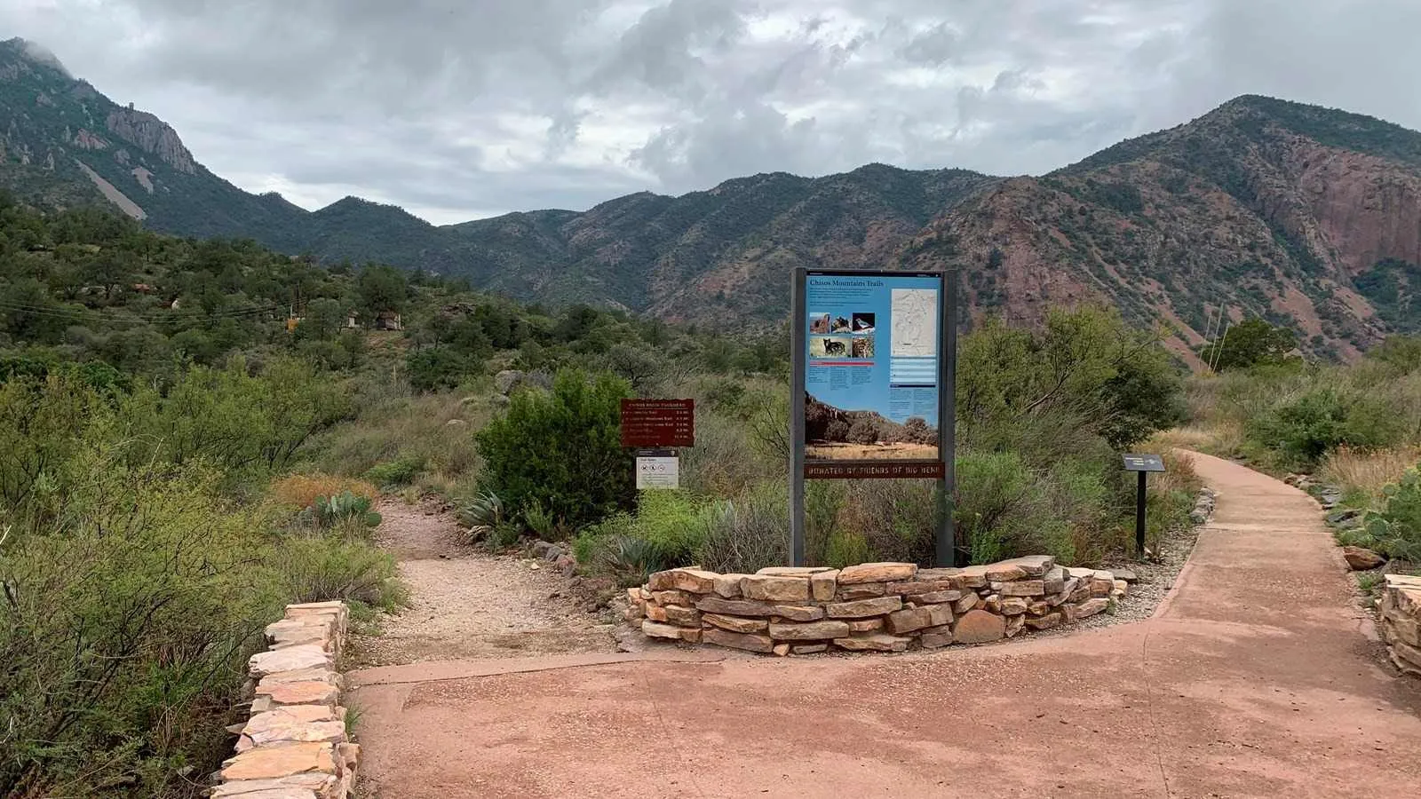
3. Basin Loop Trail: A Classic Easy Hike
- Distance: 1.9 miles (loop)
- Elevation Gain: 350 feet (corrected for accuracy)
- Difficulty: Easy
- Duration: 50 minutes
- Trailhead: Chisos Basin Trailhead
Short but sweet, the Basin Loop Trail is a beginner-friendly gem in the Chisos Mountains. You’ll pass towering rock formations, “balanced rocks” shaped by eons of erosion, and pockets of greenery rare in the desert. It’s a great warm-up for longer hikes or a standalone outing for families. Pair it with a meal at Chisos Mountains Lodge afterward.
Geology 101: The Chisos Basin formed from volcanic activity 35 million years ago—those rocks tell a story!
Photo Op: Sunset here lights up the Casa Grande peak in fiery hues.
Note: Leashed dogs are welcome, making it a pet-friendly option.
4. Window Trail: A Moderate Journey to a Stunning Frame
- Distance: 5.6 miles (round trip)
- Elevation Gain: 960 feet
- Difficulty: Moderate
- Duration: 3-4 hours
- Trailhead: Chisos Basin Campground
Don’t mix this up with Window View Trail! The Window Trail descends from Chisos Basin through Oak Creek Canyon to “The Window”—a natural rock frame with sweeping desert views below. The downhill trek is a breeze, but the 960-foot climb back up will get your heart pumping. Watch for seasonal wildflowers like Big Bend bluebonnets in spring.
Safety First: The pour-off can be slick after rain—check conditions at the visitor center.
Reward: Stand at The Window and hear the wind howl through the gap—it’s hauntingly beautiful.
Gear Tip: Wear grippy boots for the rocky return.
5. Hot Springs Historic Trail: Soak in History and Nature
- Distance: 1 mile (round trip)
- Elevation Gain: 354 feet
- Difficulty: Easy
- Duration: 30 minutes (plus soaking time)
- Trailhead: Hot Springs Parking Lot
This trail is a two-for-one: stunning nature and a peek into Big Bend’s past. It leads to 105°F natural hot springs along the Rio Grande, where you can soak amid remnants of a 1900s bathhouse built by J.O. Langford. Petroglyphs and old structures add a cultural layer to the short hike. Bring a swimsuit and towel—the warm waters are a desert luxury.
History Bit: Langford came here in 1909 seeking relief from malaria—and stayed for decades.
Crowd Alert: Weekends get busy; midweek mornings are quieter.
Bonus: Dip your toes in the chilly Rio Grande just steps away.
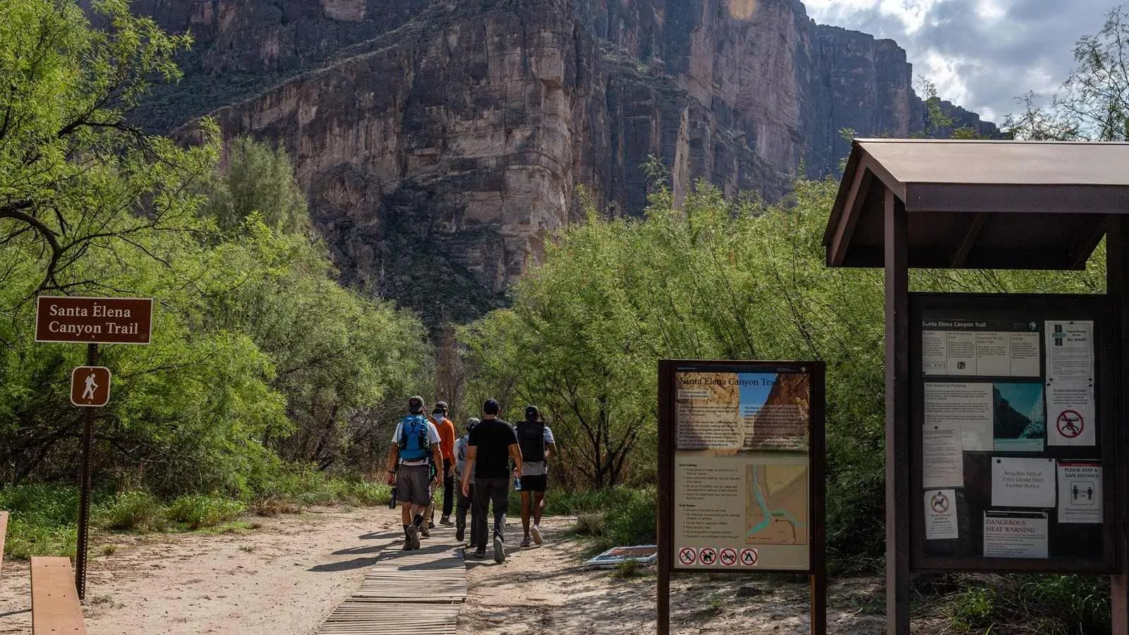
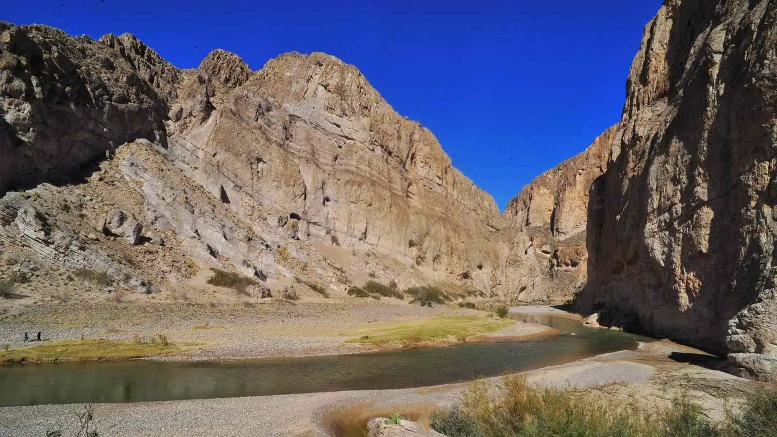
6. Santa Elena Canyon Trail: Riverside Bliss
- Distance: 1.7 miles (round trip)
- Elevation Gain: 100 feet
- Difficulty: Easy
- Duration: 1-2 hours
- Trailhead: Santa Elena Canyon Parking Area
Santa Elena Canyon Trail is Big Bend’s postcard hike. You’ll walk beside the Rio Grande, framed by 1,500-foot limestone cliffs that straddle the U.S.-Mexico border. A brief climb rewards you with a canyon overlook—bring your camera. It’s short, flat, and perfect for all skill levels, though flooding can close it after heavy rain.
Nature Note: Look for river otters and great blue herons along the water.
Timing: Early morning light paints the canyon walls golden—pure magic.
Caution: Wear sandals or waterproof shoes if crossing Terlingua Creek.
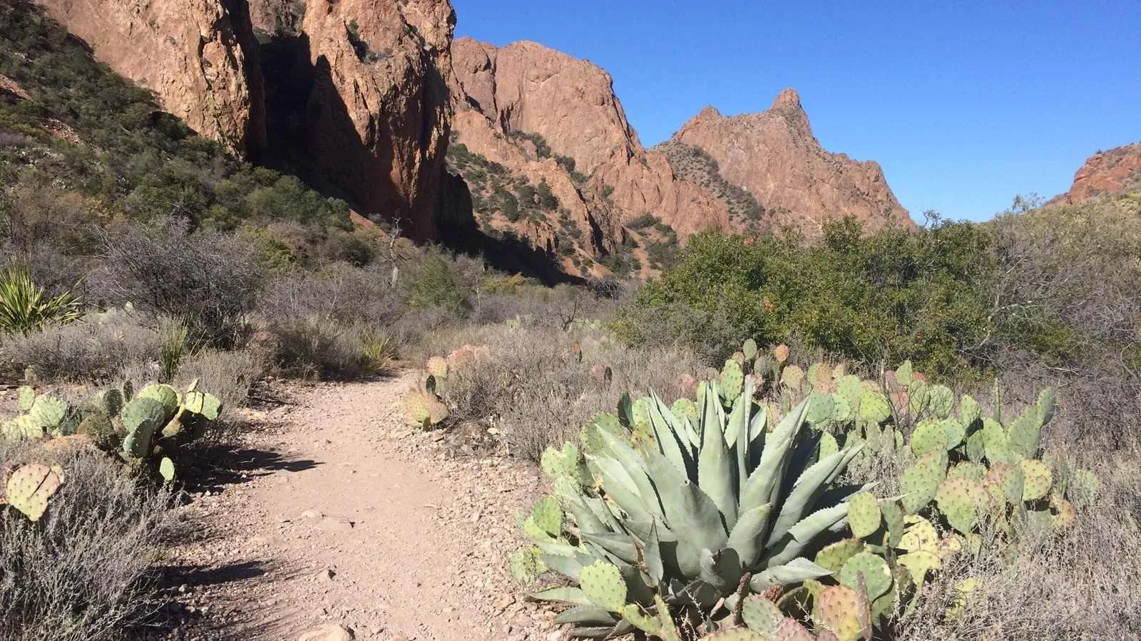
7. Emory Peak Trail: Conquer the Park’s Highest Point
- Distance: 10.4 miles (round trip)
- Elevation Gain: 2,440 feet
- Difficulty: Strenuous
- Duration: 5-7 hours
- Trailhead: Chisos Basin Visitor Center
Emory Peak (7,825 feet) towers over Big Bend, and this trail is its ultimate challenge. Choose the direct route from Chisos Basin or extend your day by combining it with South Rim Trail (15 miles total). The final 25-foot scramble requires hands and feet—gloves help. At the top, you’ll see Mexico, the Rio Grande, and endless desert peaks.
Training Tip: Prep with shorter hikes; this one’s a quad-burner.
Reward: Spot the Marfa Lights on clear nights—mysterious and mesmerizing.
Essentials: 4 liters of water and high-energy snacks like nuts or jerky.
8. Window View Trail: Accessible Beauty
- Distance: 0.3 miles (loop)
- Elevation Gain: 50 feet
- Difficulty: Easy
- Duration: 20 minutes
- Trailhead: Chisos Basin Visitor Center
Paved and wheelchair-friendly, Window View Trail loops around a hill with stunning Chisos Mountain views and a peek through The Window. Benches make it a prime sunset spot—watch the sky blaze orange and pink. It’s a quick escape near Chisos Mountains Lodge, ideal for winding down after a big hike.
Accessibility:* Smooth pavement suits strollers and mobility aids.
Sunset Hack: Arrive 30 minutes before dusk for the best light.
Bonus: Listen for owls hooting as night falls.
Window View Trail
9. Tuff Canyon Trail: A Desert Gem
- Distance: 0.75 miles (round trip)
- Elevation Gain: 145 feet
- Difficulty: Easy
- Duration: 30 minutes
- Trailhead: Tuff Canyon Parking Lot
Tuff Canyon Trail is a hidden delight off Ross Maxwell Scenic Drive. It starts near the highway with Cerro Castellan looming west, then dips into a volcanic ash canyon. Two overlooks along the south rim offer postcard views of this quiet corner of Big Bend. It’s short but feels worlds away from the crowds.
Geology Lesson: “Tuff” is compressed volcanic ash from eruptions 30 million years ago.
Photo Tip: Catch the canyon’s shadows at golden hour.
Quiet Escape: Rarely busy—perfect for solitude seekers.

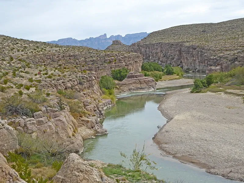
10. Boquillas Canyon Trail: Rio Grande Serenity
- Distance: 1.6 miles (round trip)
- Elevation Gain: 215 feet
- Difficulty: Easy to Moderate
- Duration: 1-1.5 hours
- Trailhead: Boquillas Canyon Parking Area
Echoing Santa Elena’s charm, Boquillas Canyon Trail follows the Rio Grande with a twist: a steep hill at the start offers better views than the nearby overlook. After the climb, it’s a flat, scenic stroll past river reeds and limestone walls. Across the water, the Mexican village of Boquillas adds a cross-border vibe.
Cultural Touch: Local artisans sometimes sell crafts along the trail (cash only).
Wildlife Spotting: Watch for javelinas and roadrunners in the brush.
Best Light: Afternoon sun highlights the canyon’s curves.
Why Big Bend in 2025? Plan Your Hiking Trip
Big Bend National Park blends raw beauty with rich stories—think ancient fossils, Apache history, and over 450 bird species. Spring and fall 2025 promise ideal hiking weather (50-80°F), while winter offers solitude and summer tests your grit. Before you go:
- Check Conditions: Visit nps.gov/bibe for updates on closures or water levels.
- Permits: Backcountry camping needs a permit—grab one at the visitor center.
- Leave No Trace: Pack out trash to keep Big Bend pristine.
Ready to explore? Gear up with our expert tips at NationalParkShops.com and make 2025 your year to conquer Big Bend’s trails!
>>Read more: